问题
I am trying to draw a semi-circle in google maps using Geodesics Points between 2 latitude and longitudes.
I found a place that had exactly what I needed: http://maps.forum.nu/temp/gm_bearing.html
It was using the API V2 and I need the V3.
So I converted it.
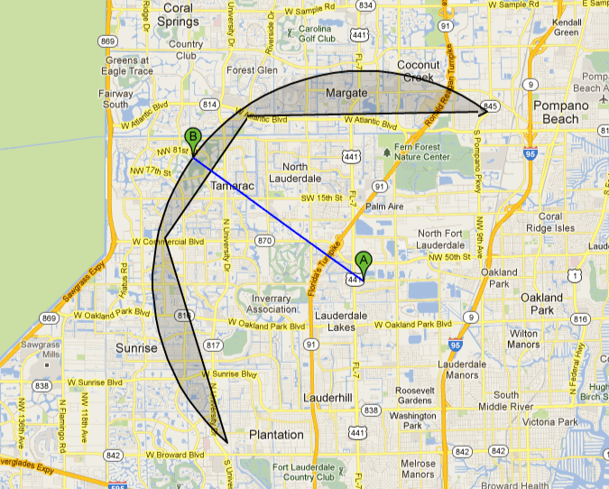
The problem im having is that the semi-circle isnt being drawn correctly and i cant figure out why.
This is what happens when the semi-circle is drawn.

But when I zoom out or I make the semi-circle smaller it looks fine.

I have reproduced the issue in jsfiddle.
http://jsfiddle.net/Morlock0821/4dRB2/1/
Any help would be greatly appreciated.
Thanks.
回答1:
Remove these line in the drawCircle function:
var basePoints = calculateGeodesicPoints(circlePoints[circlePoints.length - 1], circlePoints[0]);
while (basePoints.length) {
  circlePoints.push(basePoints.shift());
}
 http://googlemaps.googlermania.com/google_maps_api_v3/en/draw-semi-circle.html
来源:https://stackoverflow.com/questions/13993938/google-maps-polygon-incorrectly-rendered